![[Oxford Town Hall 1897 coat of arms]](/images/photos/Local_history_section/Oxford_Town_Hall_1897_coat_of_arms_smaller.jpg "Oxford's coat of arms in the Town Hall (opened 1897)")
Oxford's coat of arms, showing an ox fording the river Thames. This example is in the Town Hall on St Aldates. There is an explanation of the parts of the coat of arms on Stephanie Jenkins's Oxford History website.
The oxen ford and the Grandpont causeway
The name ‘Oxford’ derives from 'oxen ford' - a ford for oxen across the River Thames - which existed here long before the town acquired any distinct urban identity in the early 10th century. At this point the river splits into many channels and hence was relatively shallow and easy to cross on foot, enabling people, goods and animals from the Midlands to pass safely to the south of England and vice versa. Oxford’s prosperity in the Middle Ages (and later) owed much to its position on the site where this north-south trade route (which ran roughly along the line of the present A34) crossed another important route running east-west, from London to the West Country and South Wales (roughly along the line of the present A40).
Archaeological excavations on St Aldates, and the discovery of a silted-up Saxon ford, paved with stones, near the present Folly Bridge, suggest that the 'oxen ford' was sited to the south of where the city later grew up, in present-day Grandpont. In the medieval period the area south of what is now Folly Bridge was open marshy meadowland, interlaced by streams and bisected by the north-south causeway or grand pont ('great bridge') carrying the north-south trade route as it approached Oxford. This causeway probably originated in Anglo Saxon times but was rebuilt in stone in the late 11th century by Robert d’Oilly, the French nobleman who came to England with William the Conqueror and who in 1074 built Oxford Castle; he died in around 1091.
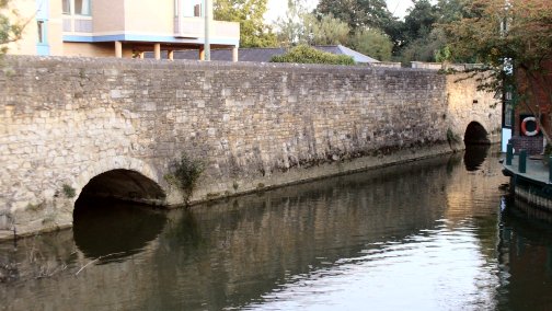
Two of the rubble stone arches of the Grandpont causeway, just south of Folly Bridge. Between Folly Bridge and Whitehouse Road there are eleven arches, six of which are still visible above ground; the rest, and those further south, have become silted up and filled in over the centuries.
The earliest phase of the ragstone causeway was between 3.9m and 4m wide and was constructed as a continuous linear structure with arches set along its length where river channels or drainage needs dictated. By the 16th century Grandpont causeway comprised more than forty arches and stretched from the bottom of St Aldates to the foot of Hinksey Hill – from the site of Folly Bridge to the site of the current Redbridge Park & Ride, along the line of what is now the Abingdon Road. The causeway has been widened on at least two occasions, giving it a modern width of c. 12.5m.
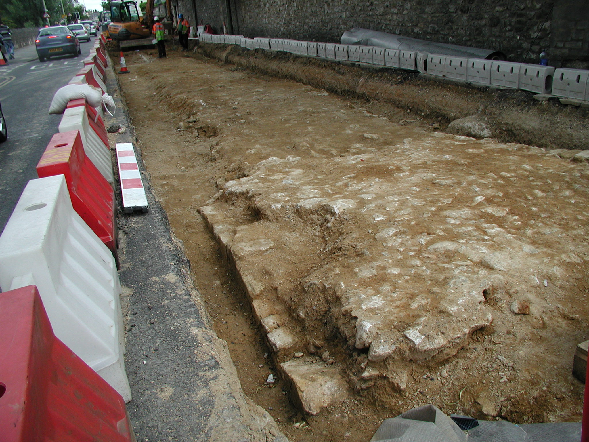
During resurfacing of the northern end of the Abingdon Road in the summer of 2004, the tops of several of the (narrower) Grandpont causeway's arches were exposed, only a few inches beneath the modern surface. Image courtesy of Graham Smith.
Before the housing developments of the mid-19th century there were a number of settlements and other buildings along the Grandpont causeway. After the Whitehouse football ground closed in 1988, excavations on the site in 1992 revealed that there had been a Middle Iron Age rural settlement here from the 3rd to 1st centuries BC (long before the city of Oxford existed), whose inhabitants were subsistence farmers. In the mediaeval period cloth and leather played an important part in the town’s economy and flax-retting (to produce usable fibres) and leather-working were apparently carried on in the Grandpont area in around 800. In the 11th century there were at least five watermills in Oxford, two of which were on the west side of Grandpont, belonging to Eynsham Abbey. Excavations on the former Whitehouse football ground revealed traces of 12th- to 14th-century settlements there. A survey of Oxford in 1279 listed 1,114 properties in the town, 62 of them 'on Grandpont'. These included Abingdon Abbey's Eastwyke Farm (now the site of the Oxford Spires Hotel) and the chapel of St Nicholas - a hermitage and oratory where business with Abingdon Abbey was transacted - which stood where the garden of 80 Abingdon Road is now. Alms were collected at the chapel to pay for repairs to the causeway and to South (Folly) Bridge. After the dissolution of the monasteries in the mid 16th century a cottage was built on the site, known as the Archdeacon of Berkshire’s Court (which survived until at least 1620). Opposite it (on the site of present-day Grandpont Villas, on the eastern side of Abingdon Road) was a house occupied by the bridgewrights or bridge hermits who were responsible for carrying out repairs to the causeway and bridge.
![[Grandpont causeway c. 1500]](/images/photos/Local_history_section/Suburban_development/Follly_Bridge__Grandpont_Causeway_from_an_estate_plan_of_c._1500_Hurst_Plans__Drawings_of_Oxford_MS_Top_Oxon_a.18_20_cropped.JPG "Grandpont causeway c. 1500")
Drawing of an estate map of c. 1500 (with east at the top) showing arches of the Grandpont causeway, with Friar Bacon's study at the far left (at the southern end of Folly Bridge). The chapel of St Nicholas is the small building with the steeply-pitched roof, standing end-on to the western side of the causeway (in 'Cow Meadow'). Opposite it was the hermitage occupied by the bridgewrights. Drawing by Herbert Hurst, Plans & Drawings of Oxford, 1913; © The Bodleian Library, MS Top Oxon a.18, 20.
- Read more about Folly Bridge, which carried the Grandpont causeway over the river.
- Read more about the archaeology of the Grandpont causeway and Folly Bridge in Brian Durham et al, 'The Thames Crossing at Oxford: Archaeological Studies 1979-82', Oxoniensia, vol 44, 1984.